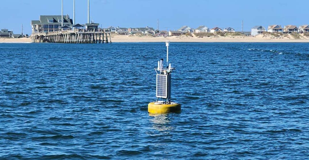
Those recently visiting Jennette’s Pier in Nags Head, NC may have noticed a tall, yellow buoy floating in place just off the pier.
In late 2024, the Oceanography & Marine Hydrokinetic Energy Lab at CSI, in partnership with NOAA’s Ocean Systems Test & Evaluation Program (OSTEP) located in the Hampton Roads area of Virginia, deployed an ocean observing buoy at an 11-meter test site near the pier. The approximately 33-foot deep test site is part of the Jennette’s Pier Wave Energy Test Center, a federally designated shallow water platform for testing marine hydrokinetic energy devices and components in the open ocean. The wave energy test center is the result of a partnership between Jennette’s Pier and the Coastal Studies Institute and is managed by the North Carolina Renewable Ocean Energy Program and Jennette’s Pier.
The recently deployed buoy can collect data for a variety of ocean and environmental conditions including wind speed and direction, humidity, air and sea surface temperatures, salinity, and ocean current speed and direction. It will remain at its location for at least one year and will provide valuable information about test site conditions which in turn will be crucial when preparing for future renewable energy device deployments. While the buoy is on site, members of the Oceanography and Marine Hydrokinetic Energy lab and additional CSI staff will provide buoy monitoring and maintenance.
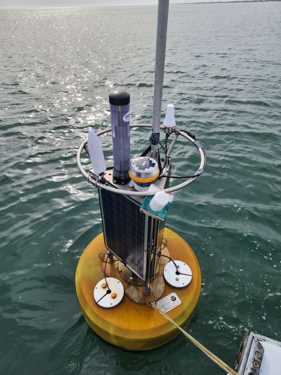

The initial deployment of the buoy at Jennette’s Pier was originally scheduled for early to mid-2024 but was delayed upon the collapse of the Francis Scott Key Bridge in Baltimore, MD. The buoy was instead sent there first to provide essential water measurements amidst recovery efforts.
To see current conditions at Jennette’s Pier and those observed in the last 48 hours, users can view the Station Dashboard; or, to view conditions in a quick, digestible manner, users may choose to bookmark the links provided by yellow (tides, temperatures, wind) and blue (currents) map pins. Though first used in an emergency relief scenario and now being used to inform future renewable energy projects, members of the public may also find these real-time measurements helpful when planning water-related activities in the vicinity of the pier.
The static map, above or right, depicts the approximate location of the buoy. If using NOAA’s Tides and Currents web interface (linked in story above) users can see current conditions by clicking on either the yellow or blue pins. The buoy’s exact location is 35° 54.6 N, 75° 35.5 W.


 Based at the Coastal Studies Institute (CSI), the North Carolina Renewable Ocean Energy Program (NCROEP) advances inter-disciplinary marine energy solutions across UNC System partner colleges of engineering at NC State University, UNC Charlotte, and NC A&T University. Click on the links below for more information.
 ECU's Integrated Coastal Programs (ECU ICP) is a leader in coastal and marine research, education, and engagement. ECU ICP includes the Coastal Studies Institute, ECU's Department of Coastal Studies, and ECU Diving and Water Safety.
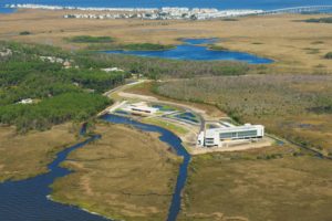 The ECU Outer Banks campus is home to the Coastal Studies Institute.